Pages

Tuesday, May 14, 2013

Ba Ria - Vung Tau beaches

Ba Ria - Vung Tau Province has a hundred kilometers o shoreline, including seventy-two kilometers of sand dunes. The topography of the province includes the dunes as well as hills, mountains, and small deltas. Ba Ria - Vung Tau has a monsoon tropical climate. The rainy season with its southwest monsoon runs from say to October; the dry season with winds from the northeast runs from November to April. The annual average temperature is 270C . Ba Ria - Vung Tau province is a key gateway for the country's southeast provinces to the Eastern Sea. Thus, it plays a strategic role as an international seaport, particularly for other Southeast Asian nations.
Vung tau tourist information
Kites on Bai Sau - a beach in Vung Tau
The beautiful beaches near Vung Tau town have great allure. Local authorities and business leaders wishing to entice tourists to their shores have decided the natural wonders need spicing up with a bit of man-made fun. Jet skiing is a new craze. Nearly a hundred jet ski businesses operate on Vũng Tàu's beaches; the city's Beach Management Board claims they are both speedy and safe.

Visitors have several choices: A three-seater has a top speed of between 110 and 150 kilometers per hour, whereas a two-seater travels at a more sedate rate of between fifty-five and seventy - five kilometers per hour. Drivers start at a low speed and play relaxing music as their guests settle in but will turn up the throttle for those wanting a rush. The more adventurous will soon be holding their breath and trying to quell the adrenaline as their racing craft tackles the huge waves. Don't worry: The drivers' skills are up to the task of keeping visitors safe until the ride is over.

Others might prefer a trip to the scenic mountain peaks of Nui Lon (Big Mountain) or Nui Nho (Small Mountain). Nearby are the legendary White House (once a famed fortress) and a seven-story statue of Jesus Christ that blends Vietnamese and French influences. The forest's seductive perfume of cajeput and red jasmine lingers in the memory long after a walk in the mountains, reminding visitors of the unforgettable beauty of the land and the charm of its people.

It' not a perfect trip if your trip of Ba Ria - Vung Tau lack of making the trip out to the Con Dao Archipelago event though the site is only a short plane trip or an inexpensive boat ride away. Seven island cruises can help visitors appreciate the splendour of Con Dao Archipelago, including the tropical forest of Bai Ong Dung, the reddish gold or snow – white sand of Bai Dam Trau, and the coral reefs and multi – colored fish around Hon Tre Lon and Hon Tre Nho. Visitors can stop over at Bến Đầm to watch the bustling fishing boat traffic in the harbour. From Bem Dam, they can go on to observe the antics of the red-faced monkeys on Hon Tai and marvel at the immense forests of coconut trees on Hòn Cau. The can travel on to Hon Bay Canh to watch sea turtles coming ashore to lay their eggs. 

Ba Ria - Vung Tau Province’s Touris Service is planning to develop yet more entertainment and sight-seeing choices to make a trip to the region even more satisfying. Nevertheless, current services are sufficient to ensure that visitors can relax, enjoy themselves, and appreciate the natural environment
- Beaches in Vietnam -

Cat Ba Island Travel Information

Located thirty miles from the town of Hai Phong, the tourist destination Cat Ba island is famous for its romantic karsts seascape, with towers rising steeply from the sea. Some visitors find it even more beautiful than neighboring Ha Long bay. Its national park is home to a diverse, endemic forest flora and one of the world's most endangered primates, the golden-headed langur. Cat Ba is a perfect place to relax, and it's less than three hours from Ha Noi. 

Cat Ba Island Information
Cat Ba island
Visitors stepping off the boats find themselves in Cat Ba Town nestled around a bay filled with colorful fishing boats. Friendly hotels and restaurants border the promenade. The first afternoon is est spent admiring the landscape at the Cat Ba Beach. For dinner, try Xuan Hong floating restaurant next to Beo Harbour, since it serves the best seafood in town.

To sea the golden-headed langur, talk to Mr.Phung at Beo Harbour. Silent and patient observation with the aid of binoculars at 5:00 A.M. may pay off handsomely with the sight of a langur troop feeding on a cliff face seventy meters high. However, getting there requires a three-hour trip. Extending the journey in to a day trip around Lan Ha bay brings the reward of seeing spectacular karst gorges and towers, with small, secluded beaches alongside turquoise water. 

Hotels in town can book a tour of the national park, including a forest trek and a stop at the Trung Trang caves. The most demanding and spectacular day trek leads past Frog Lake, which is surrounded by swamp forests, and continues through primary forests to the fishing village of Viet Hai with a return trip by boat to Cat Ba. 

Another possibility for your Cat Ba trip is to hire a motorbike for VND 100,000 (US$ 5 - price 0f 2013) per day and visit the national park headquarters. From there, Frog Lake is a short trek. Or climb Ngu Lam Peak with its fantastic overview of the karsts landscape and forest ecosystems; the short climb requires only one hour for a roundtrip. A further drive to Phu Long will likely include sightings of shorebirds in the mangrove forests and mudflats or near Kim Cuong cave on Cat Ba island.
- Islands in Vietnam - 

Monday, May 13, 2013

Travel of Beaches in Center Vietnam

Canh Duong, which is sixty kilometers from Hue City, is widely regarded as the most beautiful beach of Thua Thien Hue province. The eight kilometers of beach arc between the Western and Eastern Chan May Mountains. The beach is sheltered, and its sand is white and fine. Cảnh Dương is popular with tourists and local residents alike and is famous for its many sporting activities. 

Lang Co Beach, stretches along National Highway 1A for 10km with white sand and clean and shallow waters. Looking Lang Co from the northern side of Hai Van Pass, one can see the rows of coconut trees and simple roofs adjacent to a sand dune similar to a visor stretching out the sea.
Since coming into operation in 2001, the Lang Co Tourist Park has become a key tourist and beautiful site in Viet Nam and the region. The park is built in a white-sand dune covering an area of 10 hectares. The pleasure-houses here are designed in the Hue traditional styles combining the architecture of mausoleums, palaces, temples, pagodas and the green areas of garden-houses in Hue.
In Lang Co, tourists can have chances to admire white sand-dunes under the shadowy rows of coconut trees and take part in
interesting activities such as sea-bathing, beach-volleyball, tennis, sea diving, and fishing in the open sea.
Around Lang Co, visitors can experience other pleasures in exploring springs, caves, waterfalls, lakes, and stone grounds of
natural and virgin beauty. Near the beach, there are many tourist attractions such as Chan May Mountain, Tu Hien Estuary, fishing village.

Vietnam travel guides
Lang Co beach
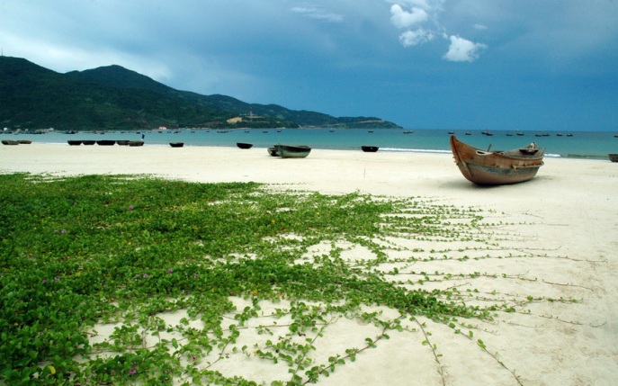
Non Nuoc Beach, known during the American War as ''China Beach,'' runs for five kilometers alongside the Marble Mountains and is bordered by Dien Ngoc Sea to the south and Da Nang City to the north. The water here is famous for its' clarity. Local residents cultivate and harvest seaweed for export. Non Nước is popular with domestic and foreign tourists, who can stay in the several five-star hotels or in less expensive housing. 

Dai Lanh Beach which is eighty kilometers north of Nha Trang and close to Highway 1, has been famous throughout history for its white sands and sea-pine trees. In fact, "Dai Lanh'' was carved on the of the Nine Urns in the Mieu Courtyard, which King Minh Menh (rule: l820-l840) built in Hue. 

Nha Trang Travel guidelines
The beach city of Nha Trang
Nha Trang City has a population of 300,000 yet has retained a small-town atmosphere. This city 442 kilometers north of Hồ Chí Minh City is well known for its friendly people and for its ten kilometers of prime beaches with year-round warm water (average temperature of 260C) and the lowest humidity in Viet Nam. Famous nearby islands are the Truong Sa (Spratleys), Hon Tam, Hon Tre, Hon Yen, and Hon Rua. 

Mui Ne - Hon Rom Beach Area is two hundred kilometers from Ho Chi Minh City and eleven kilometers east of Phan Thiet. Its huge sand dunes have been the subject of many photographs and video clips. Visitors can follow the Suối Tiên (Fairy Spring), a stream that run through some of the dunes. The beach, which is internationally known among wind and kite surfers for its prime wind conditions, boasts outstanding facilities for guests.
- Beaches in Vietnam -

Do Son Beach Travel

Do Son a small peninsula 22.5 kilometers in length between the Lach Tray and Van Uc Rivers, is a famous seaside resort twenty kilometers southwest of Hai Phong and a little over a hundred kilometers from Ha Noi. Thousands of sandalwood trees shade its beaches,  which are surrounded by mountains covered with pines. On summer day, Do Son is alive with tourists from all over the world. Ben Nghien (Sloping Wharf) at the end of Zone II has high-speed ferries running from Do Son Ha Long bay and to Hon Dau and Cat Ba islands.
beachs of Vietnam
Do Son beach
Vietnamese say Do Son is like a dragon's head facing a precious stone (Hon Dau island) and that Bach Long Vi island nearby looks as if it were created by the dragon's whisking tail. Do Son’s Tuong Long Tower atop Ngoc Son Mountain dates from the eleventh century. Only the foundation of the ten-story tower remains. However, the inscription on the bricks is clear: ''Ly gia de tam de, Long Thuy Thai Binh tu nien tao'' (The third Ly emperor, the fourth year of Long Thuy Thai Binh [King Ly Thanh Tong]). This would place the date at 1057.

Van Ban Pagoda, once the site of the famous Van Ban Bell, is next to the tower. The bronze bell, one of the oldest in Vietnam, was cast during the Trần Dynasty (1225-1400). It is on display now at the History Museum in Ha Noi. The bell fell in to the sea during a storm and remained there for hundreds of years. Fishermen retrieved it in 1958 near Zone 1 Beach. Scholars believe the bronze contained a high proportion of gold, which protected the bell during its centuries under seawater.

Historical traces also show that the Tran kings used Do Son as a marine base. In 1288, the Vietnamese defeated Yuan - Mongolian invaders, sinking hundreds o their junks during a fierce battle in the mouth of Dai Bang River near Nhi Son Tower.

Tiny Hon Dau island has a temple to a General Nam Hai Than Vuong from the Tran Dynasty (1225-1400), who is a tutelary god protecting fishermen in rough seas. Before fishing trips, sailors stop off at the island to present offerings to secure good luck and increased confidence when facing difficult challenges at sea. Local people honour Nam Hai Than Vuong with an annual festival on the ninth and tenth day of the first lunar month.

In 1741, Nguyen Huu Cau, selected Do Son an a navy camp. The current custom of buffalo fights on the ninth day of the eighth lunar month in conjunction with a festival for the Water God grew from a ceremony Nguyen Huu Cau organised to encourage his solders.

Soon after the French arrived in Hai Phong in the 1870s, the turned Do Son into a summer resort, Vietnam travel destination for themselves and the Vietnamese upper class. Recently, developers have renovated the Vạn Hoa hotel, a French colonial resort near the end of Do Son Peninsula, to create a casino with a view of the Hon Dau island lighthouse four kilometers out to sea.

festivals of Vietnam
"Buffalo-fighting" Festival in Do Son
Attractive Do Son travel sites include: Tuong Long Tower, Pearl Temple, Dragon Stream (with remains from the tim of the Ly Dynasty) in Ngoc Hai Ward; Ba De Temple at the foot of Doc Mountain at the end of Xam Wharf in Duyen Hai Ward, a buffalo - fighting festival with the preliminary round during the sixth lunar month and the final matches at the town stadium on the ninth day of the eighth lunar month; the three beaches at Zones I, II, and III, great views from many of the restaurants, ''Wharf Without a Number,'' the starting point of the ''Ho Chi Minh Trail on the Sea'' for ships traveling from the North to the South during the American War in Vietnam, Do Son Casino, formerly Van Hoa Hotel with its French colonial architecture; the market selling fresh shrimps, tiny shrimps, oysters, dried fish, shrimp paste, sharks' fins, and the swimming bladders of conger pikes.

Of special interest is Bao Dai’s Villa on the Vung Hill. In l999, Do Son Tourist Hotel Company renovated the palace, which is about a thousand square meters. Visitors can see the great lounge where Emperor Bao Dai received visitors. They can also view the bedrooms for Queen Nam Phuong and the princes and princesses. The dining room, living room, reading room, royal private kitchen, and wine cellar have also been restores. Visitors can try on costumes like those worn by the king and queen and have their photographs taken as  they sit on a throne.
                                                                                                            - Beaches in Vietnam -

Bai Chay Beach

Bai Chay (Buring Plain), a large artificial beach close to Ha Long bay, is over 500 meters long ang 100 meters wide. Hoang Gia Tourism company’s investment has made the site popular. An asphalt road winds between the beach of  white sand and casuarina trees. Nearby are restaurants, traditional music theatre and water puppet theatres. Hoang Gia park on Ha Long road between Bai Chay tourist wharf Ha Long night market provides water-skiing and jet-skiing.

Bai Chay is associated with many legends.One describes a fleet led by Truong Van Ho with food for the Yuan-Mogolian invaders. Vietnamese defenders led by Tran Khanh Du set the entire invading fleet afire. Winds from the northeast carried sparks to the western side of Cua Luc river mouth, setting its forests aflame. Hence, the name “Bai Chay”.

Another story says the western side of  Cua Luc once had a wharf for seafaring vessels. Local shipyards used casuarina leaves to burn acorn-barnacles off the boats’hulls. People in Hon Gai and another neighbouring villages saw these fires and called the area “ Bai Chay”.
- Beach in Vietnam -
 

Phong Nha Cave travel

One of the world’s biggest and grandest cave networks is Phong Nha in Quang Binh Province. The network contains sixteen caves across seventeen kilometers. Phong Nha has been a Vietnam tourist destination for years, long before it gained UNESCO World Heritage Site status in 2003. However, because of its geographical isolation, the immense cave network attracted only the most intrepid travelers  until recently, when expansion of the Ho Chi Minh Trail into a highway from Ha Noi to Ho Chi Minh City opened up the Truong Son Region, making Phong Nha more accessible. Now, thousands of people enjoy its peace as they drift along the Son River and marvel at how, year after year, the river has pushed water through the mountains, forming some of the world’s most spectacular caverns.
Cave vietnam phong nha
Phong Nha Cave

Phong Nha contains both underwater and dry caves and a story to explain the network’s legions of stalagmites and stalactites. According to legend, the Jade Emperor descended form Heaven and began to preach his gospel to an assembled crowd, whose members stood rapt. The Jade Emperor’s listeners included local farmers and laborers as well as noblemen and academics who had traveled hundreds of kilometers. Each listened, spellbound. These followers awoke from their reverie only when the Jade Emperor boarded his boat to return to Heaven. They remained motionless is awe. Moved by their piety, the Emperor immortalized his audience by turning his listeners into the petrified forms that fill the Phong Nha Caves.
Vietnam Caves
For those who like nature discovery

Vietnamese experts and members of the British  Royal Society have explored the caves, attempting to reach the farthest nooks and crannies. From their work, geologists know that Phong Nha deserves its many accolades. Phong Nha is Vietnam’s longest underground cave network, has the tallest cave entrance, the most beautiful underground beach, the most stalagmites and stalactites, and the deepest dry cave. Its magnificence is too much for the naked eye to absorb; tourist visitors must harness their imaginations. These caves are also rich in history as sites that harbored those loyal to King Ham Nghi during the first resistance to French as well as a preparation site for those going to the south along the Ho Chi Minh Trail during the War of Resistance Against the United States.

Video of Paradise Cave - the heart of Phong Nha caves complex:
 
- Caves in Vietnam -

Sunday, May 12, 2013

Tourist Destinations of Dalat - Dalat Waterfalls

Dalat Waterfalls, Waterfalls in Dalat Vietnam.

Pon Gour Waterfall: Many people regard this waterfall fifty kilometers south of Dalat as one of the most magnificent in Indochina. Although its drop is only forty meters, the waterfall has a  plentiful supply of water and carries religious significance for local ethnic-minority people, who flock there for Lunar New Year's festivities and to pray for good luck in the coming year.
Dalat Tours
Some monks passing the Pongour Waterfall
Ankroet Waterfall: This waterfall fifteen kilometers north of Dalat and nearby Dankia Lake makes an attractive outing for tourists. The road to the waterfall winds through ethnic-minority hamlets, where residents have vegetable farms. 

Datanla Waterfall: This waterfall at the foot of Prenn Pass and near Highway 20 is ten kilometers south of Đà Lạt's city center. The easiest may to get there is by motorbike taxi. The waterfall lies in a valley not far from Tuyen Lam Lake. With its height of twenty meters, Datanla Waterfall is not as steep as the ones at Prenn and Pon Gour. It slopes gently and falls gracefully, but its pool is deep. After a walk of ten or fifteen minutes (about 300 meters) from the pass to the waterfall, trekkers come to another path that follows a long and steep slope. Youth like to jump from one rock to another and worm their way through the bushes.
Vietnamese researcher Nguyen Diep says the ''Datanla'' comes from the Co Ho phrase ''Da Tam Nha'', which means ''water below the rocks” and has been mispronounced as ''Datanla”. The banks of the stream that flows into the Datanla once served as the base and hiding places for the Lat people when resisting Chăm invaders. Eventuatly, the Lạch drove out the invaders. Thereafter, Datanla became a local resistance base whenever foreign groups invaded. 
Datanla's scenery is wild and charming. It is said that nymphs from Heaven once bathed there, hence the name ''Suoi Tien'' or ''Nymph Spring”. 
In 1998, the government classified Datanla as a site of natural beauty. 

Prenn Waterfall and Pass: Prenn Pass and Prenn Waterfall are twelve kilometers from the center of Dalat City and on Highway 20 near Datanla Waterfall. Prenn Pass, which is ten kilometers long, lies at the entrance to Dalat City The thirteen-meter waterfall is a hundred meters to the south of the slope of the pass. At its foot is a bridge partly veiled  by the rush of water. The government recognised Prenn Waterfall as a site of national beauty in 1998. 
In the Cham language, ''Prenn'' means ''an invaded area'' or ''borderline''. Several centuries a go, the Cham in the Kingdom of Panduranga on the east coast (present-day Ninh Thuan Province) invaded the land of the Lạt and the Chil, both related to the Cơ Ho. Prenn was the border area and also the battlefront between the two sides. The Cham lived on the stretch of land from Prenn through D' Ran (Đon Duong District, Lam Đong Province) to Phan Rang on the coast. The Co Ho, Lat, and Chil  lived in the area on the western side of Frenn. 
According to Cham history, this conflict took place in the seventeenth century during the reign of King Porome (1625-1651), who has great military strength and wanted to expand his kingdom westward into the Lang Bian Highlands. However, the Co Ho; the Lat, and the Chil clipped his ambition. The Cham occupied Đ' Ran for a long tim. Vestiges of the Cham dynasties can be found in the area. Some villages in Đon Duong District still bear Cham names, such as K' loong and N'Thol Ha. 

Cougah Waterfall: Also called ''Pothole,'' this waterfall is located thirty-eight kilometers from Dalat and three hundred meters from Highway 20. It is seventeen meters high and has two falls, one relatively quiet and the other gushinh. ''Gougah'' comes from the ethnic-minority language, while ''Fothole'' is an invention of Kinh (ethnic Vietnamese) people to describe the egg-shaped stones that can be seen at the foot of the waterfall during the dry season. 

Dambri Waterfall: T'his waterfall eighteen kilometers west of Bao Loc District Town on National Road No. 20 is a majestic ninety meters high and is an important stop on tours departing from Binh Thuan and Ninh Thuan Provinces, Ho Chi Minh City, and the Mekong Delta. 
“Đambri” which means ''waiting'' in the Co Ho language, combines the names of to lovers, Dam and H' Ri. According to legend, in ancient times when the stream's flow was much lighter, H'Ri often cam to the pool at the foot o the waterfall. One day, Dam (sometimes called Kđam) stopped by the stream while hunting. He say H'Ri bathing and was mesmerized by her beauty. Dam and H'Ri fell in love and married. 
One day, Dam went hunting and did not return. H'Ri waited and waited and wept so much and so long that her tears created a stream that formed a large waterfall. 
Eventually, Đam returned. Hearing of his wife's despair, he jumped in the pool at the base of the waterfall to demonstrate his loyalty. His body turned in to the lion-shaped rock at the base of the falls. People say the lion is young Dam crying over his dead wife. The Co Ho named the waterfall  Dam H’Ri, which is now mispronounced as ''Dambri''.

Dalat Waterfalls, Waterfalls in Dalat Vietnam. 

Tourist Destinations of Dalat - Dalat Lakes

Xuân Hương Lake (Fragrant Lake): Xuan Huong Lake is one of Dalat City's most famous landmarks. Shaped like a crescent moon, the lake covers five square kilometers. Its clear waters and the surrounding boulevards lined with trees make the park a favourite rendezvous for lovers. Fishing is a popular pastime, as is riding the pedal boats and relaxing with a drink or a good meal in one of the many cafes and restaurants lining the lake. 
Tourist Destinations of Dalat Vietnam
Hồ Xuân Hương - Xuan Huong Lake
Than Thở Lake (Lake of Lament):This lake, just six kilometers east of Dalat's center, lies between pine-covered hills. Local legend has it that the trees whisper a tragic love story that the lake witnessed and retains: A young couple committed suicide there in order to remain together. The light breeze across the water carries the sounds of the lovers' sobs. Visitors can see the graveside that symbolizes the couple's eternal love. The Forest of Passion located near the Lake of Lament is also popular an a result of collective imagination and is said to be a romantic place to convalesce. 

Tuyền Lâm (All Forest Lake): This lake, located close to the popular Datanla Waterfall and formed by water from Tía Spring and the upper section of Da Tam River on Voi (Elephant) Mountain, is a favourite for rowing and fishing. It is not clear when or how the lake got this name suggesting its forested environment. The water, the pines, an a nearby pagoda create an atmosphere befitting solitary souls. 

The government began building a dam at the site in 1982 to ensure sufficient water to irrigate hundreds of hectares of rice fields in Duc Trong District and completed the construction in 1987. Ever since, the lake has been a popular tourist attraction for tourists to Dalat. A boat trip gives close-up views of the surrounding hills covered in pines. Several endangered animals inhabit the pin forests. Attractive tourist sites spot the lake banks, including the hunting grounds of Bao Dai (the last king of the Nguyen Dynasty), Bao Dai Waterfall, an area for raising buffalo, and the hunting grounds of the Lạt, an ethnic-minority group. A Zen monastery sits atop the hill north of the lake. 

Đa Nhim Lake: Situated some forty kilometers east of Dalat on the road to Phan Rang, this lake is worth the trip for its spectacular scenery because it is located inside an inactive volcano. After climbing the volcano, visitors are privileged to find a panoramic view overlooking  the surrounding mountains and valleys. 

Đa Thiện Lake: This lake in the ''Valley of Love” with the imposing Lang Bian Mountain as its backdrop is a popular meeting place for lovers.

Lắk Lake: In the E - de ethnic-minority language, ''Lak'' means ''Lake of Dak Lak Province.'' The journey of 170 kilometers from Da Lat to this lake passes through the scenic Truong Son Mountain Range and by villages belonging to the M' Nong, E-de, Chu-ru, and Co Ho ethnic minorities.

Travel of Dalat, Vietnam

The name ''Đà Lạt'' combines ''Đak'' which originates from ''Đak'' and means ''water'' or ''lake'' in the local dialect, and ''Lát'' the name of the local ethnic-minority group, a subsection of the Co Ho group. The name ''Da Lat'' thus refers to the water of the Lát (Lách) people. Đà Lạt is home to many beautiful lakes, making it a popular spot for travelers in Vietnam. The city has seen an influx of tourists in recent years because of the international popularity of eco-tourism. Now, the city is song the top ten tourist destinations in Viet Nam. Climbing Lang Bian Mountain just north of Đa Lat and the many walking tracks surrounding the city are popular with both residents and tourists.
Dalat Travel
Good morning Dalat
Doctor and explorer Alexandre Yersin (1863-1943) founded the French resort in Da Lat in 1895 because he thought the Lang Bian Plateau was an ideal place for convalescence. Since that time, the town and the surrounding rugged terrain have attracted a steady stream of domestic and international tourists. Situated at an altitude of 1,500 meters above sea level, Da Lat is 300 kilometers north of Ho Chi Minh City and 110 kilometers inland from the coast.
Da Lat is often referred to as the ''City of Eternal Spring'' because its average daily temperature varies between 15 and 240C and is often sunny. The rainy season falls between April and November, with an average annual rainfall of 1.755 meters, while the dry season is between December and March. This climate allows Da Lat to grow flowers all year round, hence its other name, ''City of Flowers''. A light mist often covers the mountains and fertile valley fields surrounding Da Lat. Farmers ship fruits and vegetables throughout Vietnam; in fact, the road linking Da Lat with Ho Chi Minh City is known as the ''Road of Fruits and Vegetables''.
 
Da Lat has a mixture of ethnic minorities as well as ethnic Kinh (Vietnamese), who have moved there. Here is one of the few places in Viet Nam where local residents wrap up in warm clothes year round. The young girls of the region are renowned for their pink cheeks. Da Lat's city center boasts an array of attractions for tourists, who can visit its French-style university grounds church, and train station. The General Museum displays a good range of indigenous artifacts and various objects of local historical significance.
 
Visitors to Da Lat can also see palaces erected by French governors and Vietnamese kings, including one built by Bao Dai, Vietnam's last monarch. Da Lat is also home to at least ten ancient pagodas, the most popular ones being Linh Son, Linh Phong, Linh Quang, Thien Vuong Co Sat and Thien Vien Truc Lam. Da Lat boasts one of the oldest and most established golf courses in Vietnam. Located in hilly terrain near Xuan Huong Lake, the golf course has been upgraded to international standards for eighteen holes.
 
Travel of Dalat
A sunflowers farm in Dalat
On your Da Lat trip, you will see a wide variety of flowers - many of them rare - along the city's streets, in its markets, and in the city's parks and nurseries. Da Lat's horticulture industry is thriving; its flowers are in demand throughout the country and are particularly popular in Ho Chi Minh City Da Lat's oldest flower garden can be found near Da Lat University and Xuan huong Lake at number 2 Phu Dong Thien Vuong Street. Established in 1966 and opened to the public in 1985, this garden displays a large collection of over 300 species and includes local varieties as well as flowers from throughout the world. The garden with its roses, chrysanthemums, gladioli, orchids, and mimosa has flowers in bloom year round.
 
Da Lat boasts the highest concentration of flower species in Vietnam, with a concentration on oriental flowers such as purple peach blossoms, violet Japanese daisies, yellow chrysanthemums, red Chinese hibiscus, jasmine, night orchids, and white lilies. Growers have imported various rose species, such as Rosa Lutea (which grows from the Middle East to China) and the Rosa Indicafragans (which comes from Europe). Several newer rose species are named for celebrities, such as the Brigitte for Bridgitte Bardot, the john F. Kennedy, and Cracede Monaco, in addition to established species. One unique flower to be found in Đà Lạt is the Salem. In 1960, a Vietnamese resident of Belgium introduced the flower, which resembles bells with white, pink, and violet petals. Rose lovers throughout the country prize this species, which travels well.
 
About twenty species o chrysanthemums and daisies bloom year round. One of the most popular species is Sans-souci (Worry-free), in addition to Pensee, Violet, Cosmos, Immortal. Many species that originated in North America, Mexico, Latin America, Africa, and Europe now have Vietnamese names, such as Hoang Anh (Verge d’or), Thuoc duoc (Dahlia), Thu hai duong (Begonia Rex), Da hop (Magnolia), Mom soi (Guleule-de-Loup) Long den (Fuchsta), Phong lu (Ceranium), Xac phao (Sauge Eclatante), Sen da (Joubarbe Des Toits), Sen can (Capucine').
 
A variety of cherry blossoms (Prunus Cerasoides) that is unique to Da Lat blooms at Lunar New Years. This deciduous cherry tree, which grows well in Da Lat's temperate citmate, sbeds its leaves in autumn and remains leafless throughout the winter. First Introduced to the region in the early twentieth century, this variety differs from the japanese cherry blossom, which cannot grow in Da Lat's climate.
 
Da Lat has over 200 species of orchids, with five indigenous species recently discovered. These five feature ''Da Lat” or ''Lang Bian'' in their names: Dendrobium dalatense, Oberonic dalatensi, Eria dalatensis, Dendrobium langbianense, and Oberonia langbianesis. These indigenous species are in as much demand as the favorite locally grown imported species: Balkis, Sayonara, Chateau, and Oriental Legend. Growers sell their orchids both within Viet Nam and overseas. Da Lat's orchids grow naturally in fields in contrast to European orchids, which must be grown in greenhouses that have special heat, ventilation, and lighting systems.
 
Lam Vien Plateau and Langbiang Mountain: This area twelve kilometers north of Đà Lạt includes Langbiang Mountain, which has the area's highest altitude at 2,162 meters. It is popular with both local residents and tourists interested in adventure sports and in studying rare flora and fauna. Residents be long to the Lạt, Chil, and Mạ ethnic minority groups.
 
Dalat tourist information
A view from Langbiang mountain

The Valley of Love: This area five kilometers north of Dalat consists of hills, lakes, pine forests, and fragrant wild flowers and was known as the ''Valley of Peace'' during the reign of Emperor Bảo Đại. In 1972, engineers built a dam and created Đa Thien Lake. The valley continues to attract people, both young and old. The Forest of Elysium: This forest is thirty-eight kilometers south of Đa Lạt and is close to Highway 20. It includes the Gougah Waterfall and is noted for its raw, natural setting.
 
As a highland town, Dalat has many beautiful lakes and waterfalls. Travel to Dalat, visitor can enjoy the beauty of about twenty such these lakes of Dalat and waterfalls of Dalat.
 
Flights to Da Lat operate from Ho Chi Minh City (thirty-five minutes), and Ha Noi (one hour and forty minutes). Motorists can take two routes from Ho Chi Minh City. Highway 20 is a trip of three hundred kilometers passing through Lam Dong Province's lush Bao Loc District. Or they can take Highway 1 to Phan Rang and then continue inland on Highway 27 through an area with historic towers erected by the Cham ethnic minority, past the Đa Nhim hydro power Plant, and across the stunning Ngoan Muc Pass with its spectacular view of Dalat and the surrounding pine forests.

Airlines to Vietnam

Sorry, we'll update this soon!