Pages

Showing posts with label Forest in Vietnam. Show all posts

Saturday, November 30, 2013

Travel Guides for Dong Nai Province

Dong Nai Province, Vietnam travel guides
Capital: Bien Hoa City
Ethnic groups: Viet (Kinh), Hoa, Xtieng, Cho Ro, Cham Highlights: Cat Tien National Park, Tri An Waterfall, Hang Gon Tomb, Tan Trieu Pomelo Village

Where to travel around:

Tran Bien Temple of Literature
The temple of literature was built in the late 17th century in Buu Long Ward, Bien Hoa City. Like the Temple of Literature in Ha Noi, Tran Bien was a university for students in the South. This structure showed the tradition of encouraging and enjoying study of southerners. In December 1861 when French troops occupied Bien Hoa, this temple was destroyed. It was rebuilt in the late 20th century so that the generations of today understand the history of Vietnamese education. The new Tran Bien Temple of Literature has architectural style of the Temple of Literature in Ha Noi.
Annually, there takes place two major events in the temple. They are Xuan Vinh in the 2nd lunar month and Thu Vinh in the 8th lunar month.

Tan Trieu Pomelo Ecological VillageTan Trieu Pomelo Ecological Village belongs to Tan Binh Commune, Vinh Cuu District, 25km from Bien Hoa City, is well known for its many pomelo orchards. Visitors are likely to be offered fruit samples to taste the variety of pomelos available at Tan Trieu.
The thanh tra pomelo is easily recognizable for its mild sweetness and sour taste. Residents of Ho Chi Minh City often go on picnics to Tan Trieu Pomelo Village.

Buu Long Tourist Park
Buu Long Tourist Park covers some 84 ha on the outskirts of Bien Hoa City, 6km from city centre, 30km from Ho Chi Minh City. It is a landscape with mountains, pagodas and a large lake, some people excessively call Ha Long Bay in miniature".
The Tourist Park embraces Long An Lake, an artificial reservoir covering an area of more than 10 ha. The crystal clear lake has plenty of large rocks that have the look of small islets.
 Boats will carry visitors around the lake, and to an islet in the middle of the lake. Climbing 35m to the top of the islet, you will watch scenery of zocks and trees make the surroundings cool and pleasant, and help visitors take a comfortable rest after climbing nearly 100 steps.
Close to the lake is Buu Long mount, which reflects itself on the lake, creating beautiful scenery. Buu Phong Pagoda was built in the 17th century on the mountain. Nearly 100 steps must be climbed to reach the pagoda. The pagoda was only a thatch roofed hut at first, and was renovated and enlarged in 1829. More renovations have been made recently.
Many ancient artifacts are left at the pagoda, including clothes dating back to the Nguyen Dynasty, and lying Buddha statues. Around the pagoda are several towers, large rocks of strange shapes and very big Bodhi trees. The rocks and trees make the surroundings cool and pleasant, and help visitors take a comfortable rest after climbing nearly 100 steps.
Nearby the pagoda is Long Son Thach Grotto, meaning "the Grotto of the Dragon Mount", which contains many stalactites of different shapes, sizes and colours. The entire grotto looks like a frog's jaw.
The top of Mount Buu Long provides you with a panorama of Bien Hoa City, which houses many factories of Vietnamese and foreign companies. Also from the top, visitors can see a green stretch of fields interwoven with branches of the Dong Nai River, all creating a mountain-river-country picture.

Tri An Lake
Tri An Lake is located in Vinh An Town, Vinh Cuu District, 65km from Ho Chi Minh City and 30km from Bien Hoa City. This is a 32,000-ha lake with fresh water and 36 islands. Above of the other islands, there are two adjacent attractive ones: Falcon Island and Dong Truong Island. These two islands have beautiful, poetic and charming sights with fresh air. Tri An lake is a wonderful place to natural lovers.

Cat Tien National Park - the most interested site for those travel to Dong Nai
Cat Tien Forest Vietnam National Park
Cat Tien Forest - A Vietnam National Park
The Cat Tien National Park, known for long time as the land of crocodiles, and is globally considered the 411th biosphere reserve. The Park's area covers apart of three provinces of Dong Nai, Binh Phuoc and Lam Dong. This Park with an area of 70,548 ha consists of the Nam Cat Tien Protected Forest (39,108ha) in Dong Nai Province, extended part (26,970ha) of Lam Dong Province, and Binh Phuoc Province (4,470ha).
This natural habitat has a diverse and rich ecosystem. The Park treasures 1,362 plant species (440 timber species, 310 medicinal plants, 220 ornamental plant species, 133 orchid species). The fauna includes 62 animal species, 25 of which are listed in Viet Nam's Red Book; and 121 bird species, few of which are classified as rare species such as the white-necked cranes, Indian storks, pheasants (ga loi hong tia), ibis (co quam xanh), one-horned rhinoceros (te giac mot sung), elephants, etc.
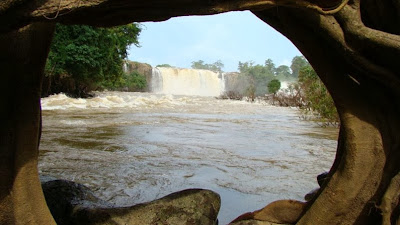
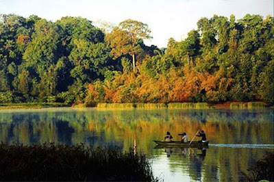
The Park also has diversified landscapes: hills, alluvial grounds, flat large grounds, strong water currents. In the rainy season, mild springs turn out fierce ones with tremendous water flows on large stones. However, meandering waterfalls create lovely yellow sandy beaches like natural beaches. Legend has it that fairies frequented this place to enjoy the cool and clean water, so it is named Nam Cat Tien (Fairy Sand). In the middle of the large river stand several islands. On the islands are old trees alternating with large grass grounds, which are the ideal place for overnight camping. Cat Tien has preserved from the past historical and cultural sites. In the past war, this place was a revolutionary base. Archaeologists have discovered remains of the Oc-Eo culture dating from the 2nd to 7th centuries AD Built at the peak of a hill near the Dong Nai River in Quang Ngai Commune, Cat Tien District, Lam Dong Province, the temple dedicated to deities belongs to the culture of Funan, a kingdom that was left unnoticed for over 1,300 years. Even now people still talk about the myths and legends associated with the construction of the temple. The Cat Tien National Park is one of the most attractive cultural and eco-tourism destinations in the Southeast Region. Tourists can experience all kinds of tours including trekking, camping, observation of animals at night to learn the life of the wild, visits to ethnic villages, boating on the Dong Nai River or Bau Sau Lake, and other adventurous tours. To reach Cat Tien National Park, from Ho Chi Minh City take National Highway 20 or go the same road to Da Lat.
Hang Gon Ancient Tomb
Hang Gon Ancient Tomb, built more than 2,500 years ago, was listed as a Historic Site by the State. The peculiar trait of the tomb is that it has been built with large flat stones. It is regarded as a type of South East Asian dolmen or megalithic construction. The ancient tomb is located in Xuan Tan Commune, Long Khanh Town, approximately 80km from Bien Hoa City.

Travel Guides for Dong Nai Province

Saturday, November 23, 2013

Destinations for Tourist around Dak Nong

Where to go around Dak Nong for Tourist

Capital: Gia Nghia Town
Ethnic groups: Viet (Kinh), E De, Nung, M'Nong, Tay
Highlights: Dray Sap waterfall, Dieu Thanh water fall, Ba Tang waterfall

Tourist Destinations of Dak Nong

Dray Sap Waterfall
Some 30 kilometers from Buon Ma Thuot City lies Dray Sap Waterfall, which means "the Misty Waterfall". This name is derived from a legend of love story between a boy and a girl who lived in this area. Everyday, H'Mi - name of the girl used to go to the milpa with her lover. One day, while resting on a flat stone, they saw a monster, whose head was as big as a mountain, eyes like bronze urns. Its body was glittery with silvery scales. Suddenly, the monster dived down from the sky and his trunk plunged into the ground, stirring up a colossal column of water. The monster spread out its large wings, flew around several times, making a fierce rain then flied away. In terrible shock, the girl disappeared into the mist. The boy was transformed into a big stump, whose roots stuck into the rock. This place was then called the Dray Sap, or Misty Waterfall.
The rains impetuously rumble down and all of a sudden stop. The sunshine filtered through foliages, making the waterfall look more miraculous. This stream looks like a mixture of water and clouds. Tourists will feel at ease here.
Nature has endowed Dray Sap Waterfall the rugged beauty of mountain and forest. The legend of the love story adds more colours to this waterfall. Save your time to visit Dray Sap Waterfall, to enjoy the pure air at night, to welcome the dawn, to hear the chirping of birds, and to have a sense of how beautiful life is!

Dray Sap Waterfall tourist Dak Nong Vietnam
Dray Sap Waterfall

Trinh Nu Waterfall - waterfall for tourist around Dak NongBefore discharging into the Serepok River, the Krong No stream snakes its way through rocky stones of many shapes and sizes, creating a magnificent natural landscape called Trinh Nu (Virgin) Waterfall. Legend has it that the name of the waterfall stemmed from a moving love story. A girl at the age of puberty had to commit suicide in the waterfall to ease her heart-rending love story, hence the name Trinh Nu Waterfall, one of the most famous tourist attractions in the Central Highlands.
Trinh Nu Waterfall is situated 1km from the town center of Cu Jut District. On the way to the waterfall, one seems to blend with nature. From a distance, the sound of the waterfall can be heard. Amidst the imposing natural landscape, tourists feel free from all the trouble of life.
Coming here, tourists have a chance to enjoy the natural beauties as well as the excellent services.

Dieu Thanh Waterfall
For a long time, Dieu Thanh Waterfall has won kudos for its pristine and poetic beauty. Dieu Thanh Waterfall is located on Dak Tit Stream, the natural border between Nhan Co Commune (Dak R'Lap District) and Quang Tan Commune (Tuy Due District). This waterfall has been stood in the middle of mountain and forest since time immemorial, despite various changes of the surrounding scene and natural environment.
Besides the biggest water column, which comes down from the height of 30m, Dieu Thanh Waterfall also comprises of some small other water columns, creating a thin mist that cools down the temperature at the foot of the rocky mountain. Under the waterfall, there are several deep grottoes and inside them there have many large and smooth rocks for tourists to take a short rest. The temperature here is always cool. When standing on the summit of the waterfall, you can admire a part of the magnificent mountain and forest of the Central Highlands.
Though Dieu Thanh is located in a calm place of jungle but it is still one of the interesting beautiful spots which not only attracts visitors in Dak Nong Province but also in other provinces such as: Dak Lak, Binh Duong, Binh Phuoc, Ho Chi Minh City and so on. Especially on festivals or Tet holidays, a lot of people flock to this place.
 
Ba Tang Waterfall - As a tourist destination of Dak Nong
It is a beautiful spot, 8km from Gia Nghia Town. To reach this waterfall, go along National Highway No14 in the contrary direction to Buon Ma Thuot. The waterfall cascades down over three levels before reaching the stream below, hence its name Ba Tang (three-storey cascade). The waterfall is about 40 m high. The first layer is not too high, water falls down from the height of 1.5m to the bottom. The second one is about 20m from the first one. In this layer, the clear blue stream flows through rocks and from a height of 2m, the water overflows downward, creating white spume. The third layer, about 20m from the second, the biggest and the main one of this waterfall, is 20m high, overflowing in two sides of the stream.
The spring is quite wide; its two banks are covered by shady trees where tourists may take a rest and enjoy the natural beauty. Looking upward, it seems to us that there is a misty veil created by the powerful flow of the falling water in an ever roaring sound.
The waterfall is surrounded by old trees. There is a large, flat ground for visitors camping, and relaxing. Together with Dieu Thanh Waterfall, Ba Tang Waterfall creates a place "S for interesting trekking tours in Dak Nong Province

Gia Long Waterfall
Gia Long Waterfall is located in Dak Sor Commune, Krong No District. Gia Long is the upper waterfall in the system of Gia Long, Dray Nur and Dray Sap waterfalls of Serepok River.
Formerly, Emperor Gia Long had a nice road built to reach this waterfall. He also intended to build a suspension bridge across the waterfall. However, the bridge was never completed and no one knows why only two bridge's piers were dug, which still remain now.
The beautiful landscape of waterfall and clear and pure lake makes the site attractive to natural lovers. 

Gia Long Waterfall tourist Dak Nong
Some Tourist on Gia Long Waterfall

Pu Prang M'Nong Village tourist destination of Dak Nong
From Gia Nghia Town, following Highway 14 towards Buon Ma Thuot City for about 28km then turn left for 2.5 km, tourists will arrive at the Pu Prang Village (Dak Rung Commune, Dak'Song District) where still preserves many unique M'Nong cultural features, works of folk literature such as: the anthem, the epic...
Pu Prang Village preserves more than 200 epics of M'Nong ethnic group (also called Ot-Nrong). The epic collection has great human values (genealogy epic set). In the village, family of Dieu Kau artist has been studying, collecting, compiling and storing hundreds of Ot-Nrong of this region. The way to show the Ot-Nrong songs is to sing (sing at mountain field, nearby the cooking fire, in the festivals...). Ot-Nrong singing expresses high solidarity in family and community, associates with the education of community tradition and is indispensable to M'Nong people after hard working days.
Coming to Pu Prang Village, visitors will have opportunity to visit the graves of M'Nong peo-pie. These are traditional relics showing decorative art; symbols and patterns elaborately carved on wood reflect the beliefs of M'Nong ethnic group. Visitors will be able to join many festivals of the ethnic minorities here if visiting the village in March.

Destinations for Tourist around Dak Nong

Saturday, November 16, 2013

Where to go around Quang Tri Province

Quang Tri, Vietnam Where to go around

Capital: Dong Ha City
Ethnic groups: Viet (Kinh), Bru -Van Kieu, Ta Oi, Hoa
Highlights: Khe Sanh Combat Base, Vinh Moc Tunnels, Truong Son National Cemetery, Quang Tri Citadel

Tourist Attractions of Quang Tri, Vietnam
 
Khe Sanh Combat Base
Khe Sanh is a valley surrounded entirely by rolling mountains and forest. Geographically, it is very similar to Dien Bien Phu. It used to be an American defence station that was believed to be unassailable.
More than 10,000 army men, not to mention many other troops ready to intervene, were stationed there.However, after 5 months of intensive battles, the Vietnamese Liberation Army succeeded in taking over Khe Sanh.

Vinh Moc TunnelsVinh Moc Tunnels 
The Vinh Moc Tunnels are a unique infrastructure of tens of underground passages in the village of Vinh Linh District. The tunnels were dug while the country was at the anti-American war, between 1965 and 1966.
The tunnels used to be thousands of meters long. But now there remain only 1,700m. This underground network is linked with 13 doors (seven opening to the sea and six to the hills). The structure is divided into three layers, the deepest being 23m underground. They are connected by a 768m main axis that is 1.6 to 1.8m high and 1.2 to 1.5m wide.
Along the two sides of the main axis are housing chambers. There is also a large 3 meeting hall with a seating capacity of 50 to 80 people, which was used for meetings, movies, art performances, surgeries, and even the delivery of babies (17 were born here). There are also four air wells, two watch stations and three water wells.
Visiting the tunnels, tourists seem to be living in the wartime, and they can meet with friendly locals who recorded numerous wonderful victories.


Truong Son National Cemetery - Quang Tri where to go around
The cemetery is located on a hill surrounded by eight hills like an eight-petal flower in Vinh Truong Commune, Gio Linh District, Quang Tri Province, close to Road No15, 25km north-west of Dong Ha City. It is 106 ha in area. The main part, 40 ha, houses 10,263 tombs of fallen soldiers and is divided into 24 smaller sections which are categorized according to localities. This part is located in 6 hills, and the memorial monument is situated on the highest hill. The Memorial of the Nation to Soldiers' Sacrifices has three sides representing the three Indochinese countries leaning on each other to fight the enemy. Between sections 4 and 5 is a group of monuments in memory of the heroism of Battalion 559 and Vietnam-Laos solidarity.
The cemetery is the resting-place of soldiers who fell on the Ho Chi Minh Trail, which has become part of the history of anti-American war, and in battlefields in the Central part of the country. This is the biggest, highly artistic memorial site showing the people's deep sorrow, gratitude and respect for those who have sacrificed their lives for the liberation of the nation. Every year, it welcomes thousands of visitors from around the country. Many foreigners have crossed thousands of miles to visit it. Truong Son National Cemetery is 9km south of the Ben Hai River.

Quang Tri Citadel
The citadel was built in 1824, the fourth year of the Minh Mang's reign, in Thach Han Commune, Trieu Hai District.
It is nearly 3km in perimeter and 4m in height. It has four doors looking to the main four directions: east, west, south, and north. Outside its walls is a trench 18m wide.
In 1972, during the anti-American resistance war for national salvation, Vietnamese liberation soldiers stationed at the citadel had to cope with American and South Vietnamese armies' huge bombings as eight times destructive as the nuclear bomb the US dropped onto Hirosima of Japan in 1945. The soldiers, however, were determined to protect the citadel for 81 consecutive days and nights, from 28 June to 16 September 1972, despite the extremely grave situation. The citadel has gone down in history as a glorious symbol of the nation's war against foreign invasion. The Vietnamese people are proud of it, and foreigners admire it.
Looking at its walls riddled with bullet holes, visitors will feel how devastating the war was. In order to commemorate the soldiers' meritorious service, a monument was set up in the centre of the citadel as a symbol of the indomitable spirit of the Quang Tri people and O army and as a token of gratitude to the sacrifices of the fallen soldiers for the independence and freedom of the nation.

where to go for tourist around Quang Tri
A gate of Quang Tri Citadel

Dakrong Beauty Spot
Dakrong beauty spot is the general name of an area graced with the romantic and majestic natural scenery of the mountains west of Quang Tri. The Dakrong River, that inspired many epic and cultural legends, runs through the area.
Over the river shrouded in mist, stands the charming Dakrong Bridge. Waterways, mountains and forest stretch as far as your eye can see. Nearby, there is a precious natural mineral water source.
Dakrong was an important site on the Ho Chi Minh Trail. Now highway 9, the Trans-Asia Highway, passed through this site en route to the international border gate in Lao Bao - Den Sa Van.

Ben Hai River and Hien Luong Bridge - A Tourist Attractions of Quang Tri, Vietnam
Ben Hai River, also known as Rao Thanh River, starts from Truong Son Mountains and runs 100km through it to meet the sea at Cua Tung (Tung River Mouth). The widest part of the river is about 200m. The portion covered by Hien Luong Bridge is approximately 170m wide.
Prior to the construction of the steel bridge, supervised by a French army engineer in 1950, the only way to cross the river was by boat. The bridge is 178m long and has seven girders. Its surface was made of wooden planks.
Under the Geneva Accord on Vietnam signed in 1954, the Ben Hai River was selected as a temporary demarcation line separating the country into two parts for military regrouping purposes. Hien Luong Bridge was then divided into two parts, each part serving as a border gate.
Today, Hien Luong Bridge has become a historic landmark and a great tourist attraction.

Cua Tung Beach
Although Cua Tung Beach is not very wide or long, it has its own beauty. The beach has sparkling blue water, silky sand, and it is touched by soft breezes throughout the year.
It is very pleasant to go on a boat down stream on the Ben Hai River and view the beautiful landscape. From Hien Luong Bridge, the tour boat will bring visitors along the river where rice and maize fields, green bamboo belts, rows of Casuarinas trees, and villages are visible far off into the distance.
In the evening, there are many albatross flying across the sky and diving down into the blue water. As night falls, it is time for wind and sea music, the sound of the waves and the whisper made by the rows of casuarinas trees.
Cua Tung is no doubt a great place for both a holiday and a rest.

Truong Son Trail - where to go around for tourist to Quang Tri
In late 1950s and early 1960s, the goods and ammunition were transported by human physical strength from the North to the South of Vietnam in service of the resistance against the US aggressors. It took six months to a year for each batch of goods to reach the south. The requirements from the battlefields posed an urgent need of mechanized means of transport. In May 1959, the Truong Son Trail was officially put into use. Later, it developed a network of crisscrossed roads, winding alongside with the Truong Son mountain range. The section in Quang Tri was considered the most pivotal point.
During the resistance, Truong Son Trail was subjected to the US fierce bombings. As the US and its lackeys failed to cut off the flow of goods from the north to the south, they launched many operations and used paratroops in the hope of destroying this supply source. Moreover, they also utilized modern electronic means to detect the targets such as electronic fences, recorders. However, the Truong Son Trail was not only protected, but also expanding on a par with the requirement from various battlefields. It spanned over 20,000km, including five main arteries, 13 crossroads, and four parallel axes. Despite numerous difficulties, the Vietnamese soldiers still ensured the smooth transportation in this trail.
Statistical data show that during the 5920 days the Truong Son Trail was put into operation, the enemy launched 800,000 sorties, of which 30,000 sorties of B-52, throwing 2.5 million tons of bombs. They launched all together 1,300 operations. The Vietnamese soldiers downed 2,455 aircrafts, putting out of action 18,470 enemy soldiers.
The Truong Son Trail, now the Ho Chi Minh Road, has gone into history as a historical evidence of the strength of our all-people war, the staunchness and bravery of the Vietnamese people.

Where to go around for tourist to Quang Tri

Monday, July 8, 2013

Tourist destinations nearby Hanoi

Tourist destinations nearby Hanoi


Co Loa Citadel & An Duong Vuong Temple
Co Loa Citadel is perhaps the most ancient citadel in Viet Nam. It was built by Thuc An Duong Vuong in the 3rd century BC to be the capital of Au Lac Kingdom (the name of Viet Nam at the time). It was built according to a helical design and was surrounded by three ramparts and a deep moat.
The remains of the citadel are located on the same site where archaeologists have found tens of thousands of bronze arrowheads, iron axes, and animal bones. Close to the citadel are the remains of Co Loa Communal House, a temple devoted to the cult of Princess My Chau and An Duong Vuong, a King who loved his daughter with all his heart but, lacking vigilance, left Co Loa and lost both his family and his country.
Co Loa Citadel is located 18km north of the centre of Ha Noi in Co Loa Village, Dong Anh District.
Tourist destinations nearby Hanoi
Coloa Citadel
Perfume Pagoda (Chua Huong)
This tourist destinations is situated in My Due District, approximately 70km south-west of Ha Noi. To go there, travelers must cross Ha Dong, then Van Dinh, to reach Ben Due Wharf. From there, a boat takes them for a scenic 3km ride on the Yen Vy Stream. The landscape displays high mountains, deep forests and streams that harmoniously intermingle with the rice fields.
Huong Tich Grotto is the most beautiful and famous of the grottoes in the area. It was discovered more than 2,000 years ago. When Lord Trinh Sam visited the grotto in the 18th century, he wrote five Chinese characters on the entrance in calligraphy: Nam Thien De Nhat Dong, meaning "the most beautiful grotto under the Southern skies". In the middle of the grotto is a statue of Bodhisattva Kuanin. Surrounding the statue are stalagmites resembling golden trees, silver trees, cocoons, hillocks, and a group of nine dragons.
Many Vietnamese visit the Perfume Pagoda to implore Buddha for happiness and good luck, as well as to immerse themselves in the beauties of nature. The Perfume Pagoda Festival begins after the New Year's festivities and lasts until the 3rd lunar month. During that period, between three and four hundred thousand people, from children to 60 and 70 year-old pilgrims, visit the Perfume Pagoda.

Thay and Tay Phuong Pagodas
Thay Pagoda belongs to Sai Son Village in Quoc Oai District, 25km south-west of Ha Noi. The pagoda was built on the slopes of Sai Son Mountain. Water puppet shows are held on Long Tri Lake, where a bridge with a tile roof built in 1602 remains.
As for Tay Phuong Pagoda, it was built in the 8th century and it is located on Cau Lau Mountain, about 35km south-west of Ha Noi. More than 200 stone steps must be climbed before reaching the pagoda where one can admire hundreds of large statues made of lacquered and gilded wood, featuring among the best specimens of Vietnamese traditional statuary art.
Visiting both sites by car or motorbike requires one whole day. It is best to leave Ha Noi early in the morning to go first to Thay Pagoda. After climbing the mountain, visitors stop in the grotto for lunch, which can not be purchased on site. They can go and visit Tay Phuong Pagoda in the afternoon in order to be back in Ha Noi before night.
 
Tram Gian Pagoda
Tram Gian Pagoda, also known as Tien Lu (fairy guests) Pagoda, is located in Tien Lu Village, Tien Phuong Commune, Hoai Due District, nearby Hanoi downtown.
The pagoda was built during the Ly Dynasty and has since been restored several times. There are one hundred sections in the pagoda. The three-entrance gate has eight roofs standing majestically on the top of a hundred brick steps. Many valuable relics are pre-served in the pagoda. In the upper hall, there is a rectangular pedestal. Also in the pagoda & is a statue of Tuyet Son Buddha carved out of black jack-tree wood. In the yard, stands a two-story bell tower with eight roofs built in 1693. It contains a 1.42m-wide copper bell Si cast in 1749. Surrounding the pagoda, there are old coniferous trees and solidly built towers.

Tram Pagoda
Tram Pagoda, also called the Long Tien (Dragon Fairy) Pagoda, is situated in the area of Tram Mountain in Long Chau Village, Phung Chau Commune, Chuong My District.
The pagoda was built in the year 1669, the seventh year of the reign of King Canh Tri. Despite being renovated on several occasions, the pagoda still retains its original artistic style of the 18th and 19th centuries, including its sophisticated engravings. The middle stone of the pagoda's three levels is beautifully engraved with the images of two lizards.

Dau Pagoda
Dau Pagoda with the old name Thanh Dao Tu, located at the end of Gia Phuc Village, Nguyen Trai Commune, Thuong Tin District, about 24km south of Ha Noi. The pagoda worships Phap Vu, one of the four Goddesses who are worshipped in the region.
A visit to Dau Pagoda helps visitors to see rare and precious exhibits of stone pedestals from Ly Dynasty decorated with lotus flowers. On staircases of the main hall, there are two stone dragons created during the Tran Dynasty in round bodies, winding as waves on blocks of stone. Visitors will be deeply interested in the ancient traditional architectures, the sculpture on beams, columns or panels... all depict legendary traditions: fairies on dragons, boys fighting tigers, or four sacred animals: dragon, lion, turtle and phoenix (long, ly, quy, phuong). Of particular note are the mummified bodies of two monks, Vu Khac Minh and Vu Khac Truong, who died meditating in the mid 17th century. Their bodies underwent extensive restoration by the Institute of Archaeology in 2003. This is the most special culture heritage in Dau Pagoda.

Son Tay Ancient
This tourist destination located in Son Tay Town, 42km nearby center of Ha Noi, the citadel was built in 1822 in a square shape. The wall of the citadel is constructed of laterite, an extremely strong type of stone. It has four gates, the east (Dong), the west (Tay), the front (Tien) and the back (Hau) gates, where watch guards used to stand. Surrounding the 2,000m perimeter of the citadel is a moat, which is 3m deep and 20m wide. Inside, there are four cannons standing"by the four corners. There is also the Kinh Thien Hall (a place for the king to relax during his inspection days in the locality), the villas and court hall of the provincial mandarins, and the food stocks and camps for the soldiers.
Time and war have destroyed many areas inside the ancient citadel. Nowadays, only some sections of the citadel walls, some gates and some other architectural works remain. The whole historical site is now being preserved and restored.

Thanh Chuong's Viet Palace
Located nearby Hanoi, in Day Dieu Slope, Hien Ninh Commune, Soc Son District, about 35km from Ha Noi's centre, Thanh Chuong's Viet Palace is a familiar tourist destination place for those who love to discover Vietnamese culture. This palace wears breaths of immemorial time blanketing houses, antiques and surrounding trees.
Thanh Chuong's Viet Palace was initially the home and studio of Thanh Chuong, one of the celebrated painters in contemporary Vietnamese art. Soon after its existence in 2002, Thanh Chuong's Viet Palace instantly became famous as a unique cultural preservation site, a spiritual legacy of Vietnamese art and culture. The simple paths, cottage houses, lotus ponds together with images of water rice civilization such as water ladles, rice mortars, bamboo beds and green-moss stone steps bring tourists nostalgic feelings I but are familiar and cosy.
The 10,000m2 palace has old houses belonging to many varied regions and cultures. However the highlight of the palace is a complex of statues made of stone, wood, bronze or ceramic installed and displayed in the houses and yards around the site. Moreover, tourists also have a chance to admire paintings of artist Thanh Chuong, works made by harmony of folk and contemporary, past and present.
At the palace, the tourists can also enjoy folk music performances of quan ho, folk singing and water puppet shows.
Opening hours: 9h - 17h30 (summer) and 9h - 17h (winter) from Tuesday to Sunday.
Ticket: VND30.000- 100,000 (Price of 2012)

Ba Vi Mountain and National Park
Tourist destinations nearby Hanoi
Tourist and a tree in Bavi
From Ha Noi, one can reach the Son Tay Town (42km) by following National Highway 32 (or by High-speed highway Lang -Hoa Lac) and then travelling another 16km in the direction of Suoi Hai Lake where rest houses have been built. Boats take visitors around the lake, stopping on islets where medicinal plants are grown and birds nest. Then, going east of Ba Vi Mountains, you can visit Ao Vua Fall. Looking from above, the fall makes a three-story cascade, the last of which flows into a small lake with emerald-green water. A 400m climb leads to the remainders of a summer villa built by the French in 1940. There is a road that allows visitors to reach an altitude of 1,200m where they can enjoy a night rest in a hotel under the starlit sky.
Back at the foot of the mountain, visitors can also explore the Ba Vi National Park, which covers a protected area of 7,377ha. The climate is temperate and there are 812 species of high - level flora. The park contains many rare animals such as the weasel (chon bac ma), tibetan bear (gau ngua), civet (cay van), flying squirrel (soc bay), white pheasant (ga to/ trang), etc. Aquatic plants are numerous with floating plants and green alga.
The park contains a great deal of creature representative for many types of climate ranging from hot and humid to cool and cloudy. From the peaks of some high mountains, travellers can have a broad view of Ba Vi landscape. The natural landscape of the rivers, mountains, lakes, and the stretching rice fields that harmoniously intermingle with the calm villages which look very romantic. The park is an ideal destination for those who love outdoors-adventurous activities and want to relax at weekends.

Bao Son Paradise Park
Located in An Khanh Commune, Hoai Due District, about 15km from downtown Ha Noi. Bao Son Paradise has both traditional and modern architecture. Passing the entrance gate, visitors seem to be lost into a tranquil world that is quite opposite to the crowded, bustling neighborhood outside. An old quarter with more than 20 houses covering an area of 5,000m2 represents life of Hanoians with traditional products in the late 19th and early 20th centuries.
A short distance further is a 10,000m2 complex of 15 typical traditional handicraft villages of Viet Nam. The houses in these villages dated back over 100 years ago with banyan tree, the well and village temple, all with an aim to enchant visitors. All create a peaceful rural environment of the Red River Delta in the old times.
The ecological area characterizing the enchanting land of Vietnam includes zoo, orchid garden, king area garden, butterfly garden, flower garden and underwater world.
A modern entertainment area has an imposing stage for water musical performance, laser movie shows, and dolphin and seal performances, with a capacity of 11,000 seats. In particular, there is a multi-functional entertainment quarter for people of different ages with impressive games and rides. In addition, there is a 4D movie theater having 48 rotating seats that makes the audience feel that they are in a fanciful world.
After touring around the area, visitors can relax by swimming in the cool pool, then going to the gastronomy court divided into two areas: stilt houses and old houses. This area offers specialties of all 3 regions of the country and other Asian dishes as well.
Ticket price (in 2012) to visit Bao Son Paradise is VND40.000 /adult and VND30,000/child for all days except Sunday with VND50.000 /adult and VND40.000 /child.

Dong Mo golf course and tourist site
To reach Dong Mo Tourist Site, 50km from Ha Noi, travel along National Highway 32 to the Son Tay Town and then continue for another 10km. Dong Mo includes a large 1,300ha lake that has many islands and peninsulas in it. On the 350ha King Island (also called Dam Island), located in the centre of Dong Mo, there is an eighteen-hole golf course. Pretty villas partially hidden in the woods mirrored in the transparent water of the lake.
Easily reached from Ha Noi, Dong Mo Tourist Site is an ideal place to escape from town and relax in a slow-paced environment.
 
Khoang Xanh - Suoi Tien Tourist Site
Nearby Hanoi, belong to Van Hoa Commune, Ba Vi District, about 60km from Ha Noi's centre, Khoang Xanh - Suoi Tien Tourist Site has imposing scenery with clear and beautiful Suoi Tien (fairy stream). Go along Suoi Tien, the scenery is wonderful with foaming fall creating marvellous sound. The tourist site has 3 areas, of which Suoi Tien Water Park consists of 20,000m2 wave-created lake, artificial sea, sliding lines of high speed and many attractive water games. Khoang Xanh hot spring area has indoor hot mineral water swimming-pool with area of 1,000m2, tubs for mud bath and hydropathy. In addition, Dinosaur Valley recreates 12 species of giant dinosaurs and serves strong feeling games.
Coming to Khoang Xanh - Suoi Tien, the tourists will be enjoyed many other services such as restaurant, karaoke, massage, sauna, camping fire, traditional song and dance...

Thac Da Eco-tourist Site
Thac Da Eco-tourist Site is located in Ba Vi Commune, about 60km west of Ha Noi's centre. This is an amazing rendezvous for nature lovers to come closer to nature and live in stilt houses of Muong and Thai ethnic tribes under stillness, coolness and greenness of -forests. Here is also the host for traditional performances such as quan ho, cheo and other artistic ethnic shows.
The fall splashes look like a giant, white and silver carpet flowing in the forest. Next to the waterfall, visitors can relax at a swimming pool, fishing pond, sports playground or a fruit orchard and enjoy indigenous specialties in small restaurants.

Tu Tram Mountains
Tu Tram Mountains are in Long Chau Village, Phung Chau Commune, Chuong My District, 20km from Ha Noi by National Highway 6.
Tu Tram is a valuable gift of nature, a chain of limestone mountains, that appear among the fertile fields creating a beautiful scenery. In 1516, under the reign of King Le Chieu Tong, a royal stop-over place was built here. The King then ordered rivers and streams to be arranged to make the area a beauty-spot for his leisure time. Nowadays, some architectural ruins, such as Long Tien Pagoda, Quan Am (Bodhisattva) Pagoda, Vo Vi Pagoda, Ba Lang Pagoda, Cao Son Temple and Mother Temple still remain around Tu Tram Mountains.
Visitors also have the opportunity to explore Long Tien Cave. The mouth of the cave is not very big, but its inner space is very large and high. Hanging down from the ceiling and the wall of the cave are stalactites of various shapes. Inside the cave, you will also find a pagoda containing a statue of Amitiyus Buddha meditating on a lotus pedestal with an honest and sympathetic smile on his face. The sophisticated carving makes the statue almost look alive. On the ceiling and wall over the cave gate, visitors can find the handwriting of talented scholars from the late years of the Le Dynasty to the early years of the Nguyen Dynasty. There are nearly 20 poems and prose passages adorning the Tu Tram Mountains.
On Trao Mountain, next to Tu Tram, is Vo Vi Pagoda, which was built in 968, and which has retained many stelae of historical and artistic value. Tu Tram Festival takes place annually on the 2nd day of the 2ndlunar month and attracts many visitors and pilgrims.

Quan Son Lake
Quan Son Lake is located in My Due District, approximately 40km from Ha Dong. The lake stretches from Tuy Lai Village, passing through Hong Son to the Cau Dam spillway. Water runs through mountain falls making the lake surface larger and more beautiful. The small peaks jutting up from the lake are bird habitats. Surrounded by mountains and clouds, the lake is quiet, cool and romantic.
Visitors can go boating and fishing and enjoy various local fish specialties. Boats can be rented at a reasonable price. 
Tourist destinations nearby Hanoi

Tuesday, June 18, 2013

Touristdestinations of Quang Binh, Vietnam

Phong Nha - Ke Bang National Park: the World Natural Heritage Site
The complex of Phong Nha - Ke Bang is 50km from the northwest of Dong Hoi City. It covers an area of 85,754 hectares. This complex is a part of the area of the oldest limestone mountains in Asia, which were taken shape 400 million years ago. In addition, it contains special values of the formation and development of the earth. Primitive forest accounts for 94 percent of the area of the entire forest, so its biodiversity is richest among Vietnamese forests. The forest boasts 568 floras and 876 faunas, many of which are listed in Viet Nam's Red Book. With the great value, Phong Nha - Ke Bang National Park was recognized as the World Natural Heritage Site by UNESCO in 2003.
Phong Nha Ke Bang Tourist
Phong Nha - Ke Bang National Park of Quang Binh
Phong Nha Grotto
The beautiful tourist destination grotto of Phong Nha is also a part of this world heritage site. It has a length of 13,000 meters with 14 large caves which are from 10 to 40 meters high. At the entrance are stalactites that look like huge teeth. Deep inside the caves are stalactites and stalagmites in various unusual shapes. A group of English geologists, together with Vietnamese colleagues, investigated Phong Nha Grotto and a number of other caves. The group boated deep inside the grotto and discovered that this is the longest underground river in Viet Nam. It is attractive to geologists, hydro geologists and explorers.
An investigation of Vietnamese and foreign geologists shows that Phong Nha has "seven best" in Viet Nam: longest cave, highest and widest entrance, the most beautiful sand and rock banks, the most beautiful underground river, the most magnificent and fanciful stalactites and stalagmites, the longest underground river, the widest and the most beautiful dry cave. Find out here more details about Phong Nha grotto.

Tien Son Grotto
400m from the entrance of Phong Nha Grotto and 130m above sea level is Tien Son Grotto. It is also known as Dry Grotto or Upper Phong Nha. Climbing to steps, visitors reach the entrance of Tien Son Grotto. Deep 1,000m inside the mountain, the grotto looks like a stone castle. Its vault is high and well-ventilated, and has white veins that seem to be gilded with silver and gold. Particularly, visitors to the grotto can enjoy acoustic resonance from slabs of stones and stone columns. When you knock at stones, they produce unusual sounds that seem to resound from the earth's womb. Tien Son Grotto is 980m long. Approximately 400m from the entrance is a 10m-deep abyss, and that is also the distance visitors are allowed to go in.
According to the studies of explorers from the British Royal Geographic Association, Tien Son Grotto was formed millions of years ago. It is even older than Phong Nha Grotto.Phong Nha and Tien Son create a beautiful picture in the complex of caves and grottoes in Phong Nha-Ke Bang Natural Heritage Site.
Phong Nha Caves are 50km from Dong Hoi City. Opening time of sightseeing site: 7am to 5pm every day.
Cultural and Ecological Tourist Center (under the National Park's Management Board): Son Trach Commune, Bo Trach District Tel/Fax: (052) 3677 323

Thien Duong Grotto (Paradise cave)
The newly-discovered Thien Duong Grotto is situated at Milestone 16 on the western line of the Ho Chi Minh Road, within the Phong Nha-Ke Bang National Park, Phu Trach Commune, Phu Binh District, about 30km from Phong Nha-Tien Son Grottos.
It is a dry grotto with no underground river. The early evaluation of the British Royal Expedition shows that Thien Duong remains untouched, with a very splendid beauty, longer and larger than Phong Nha or Tien Son Grottos. In the grotto, there are several high and wide arches with numberless strange shapes. Deep in the grotto, stalactites are much unique than elsewhere, even in Phong Nha or Tien Son Grottos. The big, round beautiful stalactites adjoining one another sparkle like stars in the dark sky.
Thien Duong Grotto contributes to promoting the values of the world natural heritage site of the Phong Nha-Ke Bang National Park.

Quang Binh Citadel Gate
This structure consists of an arch-gate and walls built in 1630 to protect Phu Xuan, the remote capital of the Nguyen Dynasty. Due to several battles and the passage of time, the citadel gate has suffered heavy damages. Fortunately though, it has since been restored to its original design.
Visitors crossing the territory of Quang Binh will be delighted by the wonderful landscapes surrounding the Citadel Gate.

Nhat Le Beach and Bau Tro Remains
This beauty spot is 2km north of Dong Hoi City, next to the Nhat Le Estuary. Nhat Le Beach is beautiful and very popular. In addition to sea bathing, visitors also have an opportunity to see the Bau Tro vestige.
In 1923, a French geologist excavated and discovered remains of primitive Stone Age people 5,000 years ago. This is the point of intersection of the Vietnamese and Cham cultures.

Ly Hoa Beauty Spot
This beauty spot of QUang Binh is situated next to National Highway 1A, 24km from the city of Dong Hoi City. Ly Hoa is a small pass at the bottom of which there are many rocks breaking through the surface of the water. Not far from there, is Da Nhay Beach, a long expanse of white sand with blue water and gentle waves.
The landscape is fascinating and an ideal place for sea bathing. Visitors can also go and see the Phong Nha Caves via the river.

Canh Duong Sea Village
Visitors can reach this tourist destination of Quang Binh by the National Highway N°1A, it's close to Roon River Mouth, very convenient for traffic between the North and the South. Canh Duong is the most bustling and prosperous village in the coastal area of Quang Binh Province. Moreover, it also has a long history and cultural tradition. In 1643, people from Nghi Loc, Nghe An Province chose the sandy area near Roon River Mouth for their settlement. With the passage of time, the village has become crowded. Fishing, seafood processing and trade have been increasingly thriving. In addition to economic development, residents also pay much attention to cultural activities. Every spring, the village organizes festival with the ritual of deities procession, and traditional games, such as human chess, rice-cooking competition, boat race, and singing contest.

Bang Mineral Hot Spring
Tourist site of Quang Binh
Bang Mineral Hot Spring
Located 60km south of Dong Hoi City, in Kim Thuy Commune, Le Thuy District, Bang Mineral Hot Spring has been recorded as the only hot water source in Viet Nam with an on-spot temperature of 105°C. The mineral water with a composition of many precious elements has become an internationally prestigious mineral water source. In addition, this hot spring is potential for resorts. Investments have been made on several ten hectares of land area for the development of swimming pools, spas, accommodation and tourist services to make Bang Mineral Hot Spring a favorite resort and wellness tourism destination of both international and domestic visitors.
Besides health and eco-tourism, the southern Quang Binh tours with many privileged natural landscapes are also favored tourist attractions of the area. These tours will provide tourists with memorable visits to the national General Vo Nguyen Giap exhibition house, the tomb and temple of mandarin Nguyen Huu Canh who greatly contributed to the national expansion to today Ca Mau Cape, picturesque An Ma Lake and many other cultural and historical vestiges.

Vuc Quanh Cultural and Ecological Tourist Site
Vuc Quanh Cultural and Ecological Tourist Site is located in Trung Nghia Hamlet 7, Nghia Ninh Commune, 4km west of Dong Hoi City, covering an area of about 10 hectares.
From the gate of this resort, follow a small path lined with trees on one side and a winding stream on the other side, one comes to a village with traditional houses having thatched roofs, walls made of mud mixed with straw. Each house has a yard, and an orchard garden with underground A-shaped shelters lying scattered around. Inside these shelters are displayed tools and equipment for kindergartens, schools, and hospitals. In the two banks of the stream are put gasoline drums and bags of rice. A network of trenches, ferries or communication lines are also built. Tourists feel like visiting Quang Binh 30 years ago, amidst its struggle against enemy fierce bombings.
Besides the war village-museum, the investor also sets up many camping sites for tourists along the stream. In addition, there is also about 1 kilometer of the reproduced Truong Son Trail.
Tourists can drive a Zin 130 truck in this rugged trail to experience the difficulties of the soldiers during the resistance war. This tourist site is just 2km away from the Ho Chi Minh Road and lies on the same route to Phong Nha Cave. It has become one of the famous tourist attractions in Quang Binh Province.

Tuesday, May 14, 2013

Travel of Bach Ma Vietnam National Park

Bach Ma National Park (Thua Thien Hue province) protects a unique natural forest stretching from the Eastern  Sea to the Vietnamese-Lao border. Located at the end of the North Truong Son Mountain Range, Bach Ma’s tallest mountain peak is 1,450 meters high. Other mountains over 1,000 meters include Nom (1,259 meters) and Truoi (1,154 meters). Long narrow valleys with complex stream and river systems surround the mountains. The eastern part on the national park has a large system of salt-water lakes and lagoons offering scenic splendors.

vietnam tourist guides
A tourist villas in Bach Ma National Park
During the 1930s, the French used the site for a tourist resort in Vietnam, which had 139 villas, a swimming pool, tennis courts, a market, post office, and a road system connecting the mountain range to Highway 1. Today, Bach Ma remains an ideal holiday resort, thanks to its natural beauty and a cool climate with summer temperatures between 18 and 23oC. the park has Viet Nam’s highest rainfall, nearly eight meters annually.

Bach Ma National Park boasts a wide range of biodiversity, including species endemic to both northern and southern Viet Nam. It has 1,406 recorded plant species, of which thirty are listed in Viet Nam’s Red Book. And even several species new to science, such as Elaeocarpus bachmaensis and Cissus bachmaensis.

The park also has diverse fauna: eighty-three, large mammal species from twenty-three families and nine orders. Among the species, sixty-eight appear in Viet Nam’s Red Book, including the sao la (Pseudoryx nghetinhensis), Vu Quang muntjac deer (Megamuntiacus vuquangensis), Truong Son muntjac (Muntiacus truongsonensis), and the white-cheeked gibbon (Hylobates gabrillae). Other animal species include birds (333 species), amphibians (21), reptiles (31), fish (39), butterflies (256), beetles (178), and termites (28). Data on small mammals are still incomplete.
vietnam tourist guides
Bach Ma National Park boasts a wide range of biodiversity

Surveys conducted have shown that Bach Ma has an especially diverse array of bat species compared with other Vietnamese reserves, with fifty-nine species recorded plus some other unidentified specimens. Eight of its species appear in Viet Nam’s Red Book 2000, and five are listed in the IUCN (International Union for Conservation of Nature Resource) Red List of Threatened Animals 2.000. Among these species, the long sells horseshoe bat (Rhinolophus paradoxolophus ) only has five known populations, with at most only between 150 to 250 bats per population. Captured bats include a Thai evening bat (Thainycteris aureocollaris), recorded only for the second time in Viet Nam. Scientists first recorded this species in 1999 in southern Viet Nam. Other species include the Old World fruit bat family (Pteropodidae) belonging to the suborder Magachiroptere. The Bach Ma fruit bats (with ten species and seven genera belonging to this family) have the most diverse species composition compared with those found in Viet Nam’s other national parks and nature reserves.

With is advantages in biodiversity and natural beauty, Bach Ma is becoming an important eco-tourist destination in central Viet Nam.
 - Forests in Vietnam -

Pu Mat National Park Vietnam

vietnam tours information
Motorbike is the best vehicle
to discover Pu Mat
Located in Nghe An Province, Pu Mat National Park is the flagship park on the northern massif of the Truong Son Mountains along the Vietnamese-Lao border. The area contains some of the world’s most threatened species. Here, in these steep forested mountain slopes of the Vu Quang Nature Reserve and in the neighboring protected area of Pu Mat National Park, a team of Vietnamese and World Wildlife Fund (WWF) scientist recently discovered a new genus of large mammal, the sao la (Pseudoryx nghetinhensis).
Visitors taking Highway 7 from coastal Vinh to Pu Mat meander west through pure, rustic beauty towards the border. The park headquarters are near Con Cuong, a small “wild west” town perched on the banks of the huge and slumbering Ca River, which is itself nestled amongst precipitous karsts peaks.

Pu Mat true wilderness with spectacular features such as the Kem Waterfall is accessible only to well-organized expeditions not to amateur tourist trips . However, the reached buffer zone shares the park’s beauty. Park staff can direct visitors traveling on foot or by motorbike to ethnic Thai or Dan Lai (Tho) village and can even help traveler arrange for stay in the villager’s stilt houses in the luscious, forested river valleys. Here, visitors can experience the park’s extraordinary diversity, although they wont’s glimpse the more magnificent wild animals, such as Asian elephants, tiger, sao la, Asian black bears, or yellow-cheeked gibbons.

Pumat Travel information
tourist rest station in Pu Mat forest
Those who stop to rest or swim in the shimmering rivers may catch a glimpse of rare, giant black squirrels jumping through the forest canopy and might hear the crested argus, a beautiful pheasant with one of the world’s longest sets of tail feather. The buffer zone is the perfect place to see local people living together with the forest. Elderly Thai women search for gold, using stick to balance themselves in the rivers. Young men and women build large wooden waterwheels to irrigate their small fields. Local villagers will guide visitors through labyrinths of karsts caves during nighttime bat surveys. Many caves are over ten kilometers long. Surveys have shown that these caves may contain the greatest diversity of bat species in Viet Nam.

Habitat destruction and hunting threaten the park’s animals and plant, which deserve the highest global priority for conservation. The Pu Mat National Park staff is working hard to save this jewel for future generations.
- Forest in Vietnam -

Friday, May 10, 2013

Cuc Phuong National Park - Rừng Cúc Phương

Located a hundred kilometers southwest of Ha Noi, Cuc Phuong National Park in the easternmost part of a limestone range emanating from the Son La Plateau in northern Viet Nam. Cuc Phuong forest is a globally important example of a terrestrial karst ecosystem  and the only remaining large area of lowland and limestone forest in northern Viet Nam. Just two hours south of Ha Noi, large shadows of the first karst towers interrupt the reflections from  the rice fields, signaling Cuc Phuong’s proximity.

Forest in Vietnam
Sunbeams in the Cuc Phuong
In the spring, millions of white and yellow migrating butterflies surround visitors as soon as they enter the park. The Eco-tourist destination should always be the Primate Rescue Center and a conversation with staff members about their efforts to rescue Viet Nam’s most fascinating primates from the wildlife trade. Extinction threatens most langurs and gibbons; Cuc Phuong is the only place to see them without spending weeks in the forest. Gibbons call from a fenced hill. Across the path, Fauna & Flora International (FFI) and Education for Nature – Viet Nam (ENV), a Vietnamese non-governmental organization, have project offices to help the national park develop Viet Nam’s first park centre for visitors. Staff members there will introduce visitors to Cuc Phuong’s unique karsts  eco-systems, including fauna and flora.

Vietnam Forest
Some visitor boating in the Park
In the afternoon, visitors can take a walk on a marked, two-hour trail to see Cuc Phuong’s giant trees in a rare stand of primary tropical forest. An incredible diversity of trees, lianas, and ferns overgrows the karsts. An   important archaeological site, which was a home of early man, is also home to seventeen species of bats. Visitors can watch endangered Owston’s palm civits, which are nocturnal, search for insects in their spacious enclosure at FFI’s small civit conservation facility. Some civits have successfully bred in captivity. It is a special pleasure to watch the baby civits.

Visitors who stay overnight can go birding in the morning chill at 6 A.M and might see bar-bellied Pitta birds and trogons just beyond the park gates. Silver pheasants and jungle fowl are plentiful. On the way home, travelers can turn left to visit Van Long, a small limestone outcrop surrounded by a wetland just before the function with Highway 1. Local villagers will row visitors in small boats so that they can come close to the rock. In addition, they can see Delacour’s langurs, a critically endangered primate endemic to the Cuc Phuong forest – Pu Luong Limestone Range. Protected by local people, the langurs cavort in the late afternoon as tourists watch.
- Forest in Vietnam -

Thursday, May 9, 2013

Fansipan Mountain

Mount Fansipan (Fan Si Pan), Indochina’s highest mountain at 3,142 meters, is located in Lao Cai province and presides over the Hoang Lien Son Nature Reserve. Vietnam’s loftiest peak is quite accessible, requiring five to seven days to reach the summit, staring from and finishing in Hanoi, an excited part of traveling Vietnam for those who like adventure and nature discovery. The climb itself starts in the valley separating mountain from Sa Pa, a popular Vietnam tourist destination. The path moves through a picturesque cultural landscape of steeply terraced rice paddies cultivated by the Black Hmong and other hill tribes. Leaving villages and farms behind, the route rapidly gains elevation and enters a forest that grown on precipitous granite slopes.
Travel Fansipan Vietnam
Conquer & contemplate
A unique assemblage of plants and animals lives here at Vietnam’s highest latitude and altitude. The tropic and temperate realms meet here, where the Himalayas taper to their eastern-most terminus. These high peaks support life forms found in no other place on the planet. During the past decade, scientists have found dozens of new species known only in the area of Mount Fan Si Pan.
Vietnam destinations
Local people carrying
tourist's luggage to earn a living

Interesting bird species found nowhere else in Vietnam include the rate and endangered beautiful nuthatch, which lives in the cypress forests of the equally rare and endangered Po Mu tree. Po Mu trees once dominated the Fan Si Pan slopes, but their value as timber led to over-exploitation and rapid decline. Long-term protection of the range’s last po mu grove is part of Fauna & Flora International’s ongoing conservation initiative. FFI hopes to help Vietnam protect the cultural and biological diversity of the Hoang Lien Son as a "Man and Biosphere Reserve.”

Muong Hoa (Flower Hamlet) appears at 2,500 meters after a trek up steep gullies through Fan Si Pan’s mountain forests. This ridge is clad in a landscape, overflowing with mosses, lichens, and orchids. This fantasy. The rock outcrop on Muong Hoa offers a view of Sa Pa and the intervening valley. The path then enters a forest comprised of bamboo. The last 200 meters to summit is the highest place in all of mainland Southeast Asia outside of distant Burma.